
Eastern Cougar Habitat Has Human Boundaries
Millions of acres of potentially suitable, prey-rich habitat remain in the eastern United States. On a map, adjoining forest can look like the beginning of cougar recovery. On the ground, that same route may cross a pasture boundary, a road, and a trailhead busy before sunrise. Each crossing requires a practical assessment of whether the people around it would accept and help manage that possibility.
Biological suitability is a starting point. Recovery would also require decisions about livestock protection, public safety, wildlife monitoring, and the treatment of residents who bear the closest risks. An occasional dispersing cougar does not establish that an eastern breeding population has returned. Keeping those two questions separate prevents a sighting from becoming a substitute for a recovery plan.
I would read any proposed corridor at two scales: the forest connections visible across a region and the particular places where a household, hunter, or trail user might encounter its consequences. The human dimensions of wildlife conservation belong in that assessment from the outset.
In this Article
A Cougar Corridor Looks Different From a Pasture or Trailhead
Ask a livestock owner about a proposed wooded corridor, and the conversation quickly reaches the pasture edge. During spring calving or lambing, a potential predator near the fence carries a different weight than it does on a regional habitat map. From spring turnout to autumn removal, grazing arrangements can also change which households have direct exposure. A useful public meeting therefore asks where animals are kept and when, rather than treating every farm near the forest as equally exposed.
Hunters may approach the same corridor through its possible effects on deer and other game. They can reasonably ask what wildlife managers intend to monitor, how they would interpret changes in game populations, and how hunting communities would be included in those decisions. Recreationists may concentrate on trail access points and routes used near dawn or dusk, where a possible encounter feels immediate. Those are different questions about the same landscape; a single measure of support can obscure them.
Distance matters, too. A person who lives far from a proposed route may support cougar recovery in broad terms. Someone whose pasture or usual walking trail borders it is more likely to ask who takes a report and what happens next. That shift deserves a practical answer, rather than a judgment about which person cares more about wildlife.
Attitude surveys capture snapshots in time. A response collected in one eastern region cannot stand in for views elsewhere without local context. Season, land use, and the precise route under discussion can change what respondents understand the question to mean. Survey results are most useful when paired with conversations at the places a proposal would actually affect.
Forest Connections Give Conservation Support a Starting Point
Some residents value cougar recovery because they want a fuller set of ecological relationships in eastern forests. For them, the animal represents more than a sighting: it raises questions about native prey, habitat continuity, and the place of large carnivores in a functioning woodland. That outlook differs from the eradication mindset that shaped earlier treatment of predators. Conservation education can make the ecological case more legible, even when it does not settle concerns about living alongside cougars.
The most productive habitat conversation often starts with the ground itself. Which forest patches connect? Where does development interrupt movement? What happens at a road crossing that looks like a thin line on a regional map? These questions let residents examine the corridor before they are asked to take a position on cougar return. They also keep a proposal honest: nearby trees do not automatically make a route usable for wildlife.
Trophic cascades belong in this discussion as a subject for ecological study, not as a promised result for a particular eastern forest. Predator presence could affect relationships among prey, vegetation, and other species, but a proposed corridor alone cannot tell a community what those effects would be locally. A conservation professional can explain the ecological reasons to protect connected forest while distinguishing that case from claims about outcomes that have yet to occur.
That distinction leaves room for common ground. A hunter interested in healthy native prey and a landowner concerned about forest condition may both see value in examining connectivity, even if they disagree about active cougar restoration. Shared interest in the landscape provides a basis for careful planning; it does not require agreement on every future management decision.
Agency Trust Is Built Around the Next Reported Conflict
Trust in wildlife agencies becomes concrete when a resident makes a report. Who verifies a possible cougar sighting? How does an agency record a livestock complaint? What evidence triggers a field visit, and when will the person who called hear back? A response plan that answers those questions gives the public something they can evaluate. General reassurance offers much less to a household weighing direct exposure.
Passive monitoring may be appropriate where managers are assessing reports and movement without a verified conflict. A confirmed conflict calls for a different discussion: which deterrents are available, who helps put them in place, and under what circumstances an agency could intervene where authorized. Residents may also judge a proposal differently if it explains how a verified livestock loss would be investigated and whether assistance is available. Stating responsibilities early helps prevent a disagreement over response from becoming a broader loss of confidence.
A practical test of the plan is simple:
Who receives the report, how is the evidence assessed, and what triggers action?
The answer should be understandable to the person at the pasture gate as well as the person reviewing policy at a desk. Agencies can make their criteria public, explain decisions after an investigation, and report back even when the evidence does not confirm a cougar. Fair treatment includes taking the concern seriously without treating every unverified report as proof of a resident animal.
This is why agency credibility matters to support for active management. People asked to accept a potential risk will look for evidence that someone can respond swiftly, explain a decision, and apply the same process fairly. Clear procedures make cooperation more plausible because residents know what they can expect when a problem moves from hypothetical to immediate.
An Appalachian Map Brings the Conversation Down to Ground
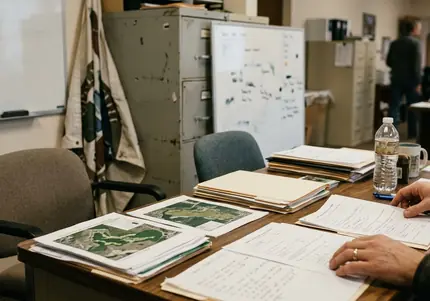
Consider an illustrative town hall near the Appalachians, before any proposed release or formal management decision. A livestock owner points to a pasture beside a wooded corridor. Across the table, a wildlife biologist marks the same boundary, then traces a road crossing and the adjoining forest. The map gives them specific places to discuss rather than a broad question about whether cougars belong in the East.
At the pasture edge, they consider where non-lethal deterrents might be practical during grazing season. At the road, they ask what movement through the corridor would actually require. The owner wants to know who would receive a conflict report; the biologist identifies the response steps that a credible plan would need to spell out. Both can talk about forest health while remaining clear about the owner’s immediate concern.
The meeting ends with the map still open. The owner’s finger rests on the pasture boundary, and the biologist’s pencil sits beside the strip of forest they have been discussing. Their next question concerns that exact place: who would come out if a report arrived from this field?