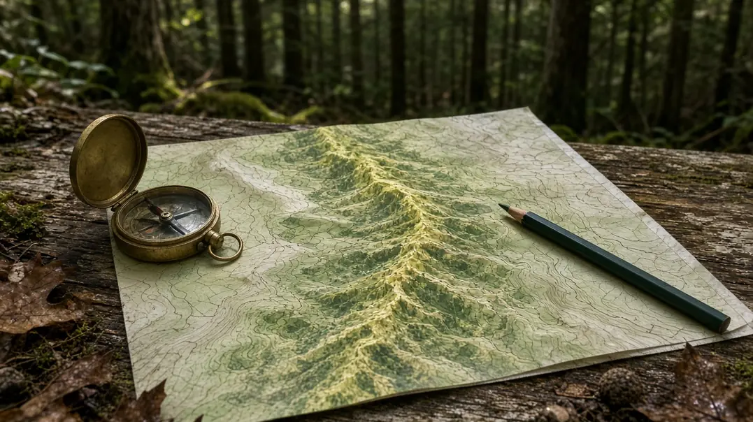
A Bright Woodland Corridor Marks an Investment Priority
A glowing swath on an eastern woodland connectivity map identifies a place to protect land, reconnect forest, or remove a movement barrier. Read it as an investment blueprint. Its practical value lies in preparing connected habitat before breeding cougar populations can return.
I start with the model documentation. A habitat-suitability map describes conditions associated with usable habitat. A least-cost model connects designated habitat cores through a resistance surface, assigning movement costs to roads, development, vegetation, and other features. Circuit-based models represent multiple possible pathways; concentrated modeled current can highlight places with few alternative routes.
Those distinctions shape the conservation proposal. A narrow connection might justify securing a parcel, investigating a highway crossing, or checking an approaching subdivision.
Modeled connectivity establishes ecological potential; cougar presence and reproduction require independent field documentation. Keep agency-verified occurrences in a separate map layer and distinguish a dispersing animal from evidence of breeding. DNA analysis can contribute to that independent documentation. Presenting a modeled route as a confirmed cougar travel path confuses the evidence and weakens an otherwise useful proposal to a state wildlife agency.
Before discussing individual parcels, record the model’s focal species, habitat-core definition, grid resolution, and source dates for land cover and roads. These details explain what the bright line actually represents.
Follow Concealed Approaches Between Forest Cores
Picture a wooded stream descending from a large forest block toward a highway. The canopy looks continuous from above. At ground level, the useful questions concern concealment: does dense understory reach the crossing, does broken terrain shelter an approach, and does streamside vegetation continue through the valley bottom?
Cougars hunt by ambush. Downed wood, rugged ground, dense vegetation, and riparian cover can provide concealed movement and hunting approaches, including places where overhead canopy opens. Assess contiguous forest alongside these ground-level structures.
Then examine the prey habitat. Young forest growth and forest-field edges provide browse for white-tailed deer, the central prey resource in planning future eastern cougar recovery. Nearby forest cover can place that food resource beside concealed hunting approaches. Read deer information at its reporting scale, accounting for hunting effort, access, and regulations when interpreting harvest records.
Give Cores and Connecting Parcels Different Jobs
Large national forest and wilderness complexes contribute extensive habitat cores. Smaller woodland parcels can connect those cores across developed landscapes, providing stepping stones for dispersing subadults.
Keep temporary passage and repeated habitat use distinct in the assessment. A narrow streamside parcel may carry a connection between larger blocks while offering little room for sustained use. Its conservation importance comes from its position in the network.
Audit the Highway Where the Forest Narrows
A corridor audit turns a regional model into a list of identifiable barriers. Follow the connection from core to core, concentrating on major roads and development fronts.
- Check the dates. Compare the model’s land-cover and road inputs with recent aerial imagery. Record the imagery acquisition date so a cleared building site and an older forest footprint remain distinguishable.
- Read the development record. Overlay parcel boundaries, adopted zoning, approved subdivision plats, and planned road extensions. Zoning describes permitted development; approved plans identify a more immediate change to the connection.
- Inspect the road barrier. Record lane configuration, concrete median dividers, interchange ramps, roadside fencing, and nearby bridges or drainage structures. For agricultural boundaries, document fence mesh, height, gates, and continuity.
- Locate the remaining passage. Measure the vegetated gap between infrastructure footprints. Mark places where a single parcel, bridge approach, or stream crossing carries the connection.
Return to the wooded stream. If highway ramps occupy one side and an approved subdivision approaches from the other, the remaining forest strip becomes a candidate pinch point. Its priority rises when alternative routes are scarce and a feasible intervention could retain passage.
Keep the coordinate system, map scale, and inspection date with the record. A landowner, biologist, and transportation planner should be able to relocate the same feature.
Secure the Crossing and Its Wooded Approaches Together
A crossing project needs protected approaches. Subdivision that severs the woods leading to an entrance can break the corridor even when the structure remains intact. Treat the road passage and adjoining parcels as one project.
Transportation engineers and wildlife biologists can evaluate several ways to carry ungulates and large carnivores across the barrier. An existing bridge may accommodate a dry travel bench beside a stream. An oversized box culvert offers another candidate, assessed through entrance dimensions, barrel length, standing water, dry footing, and sightlines. A dedicated wildlife overpass carries habitat above the roadway, with vegetation connecting both approaches.
Roadside exclusion fencing should guide animals toward the passage. Fence ends, gates, and escape provisions need explicit design attention. The Federal Highway Administration wildlife crossing design guidelines provide a starting point for that discussion.
On private timberlands, conservation easements can restrict subdivision and conversion while retaining private ownership. Agreements should address forestry, riparian protection, monitoring, and enforcement. Review working forest agreements for duration, termination provisions, road construction rights, and development restrictions.
Build support around the immediate local problem: documented deer-vehicle collisions, streamside protection, and continued woodland connections between public holdings. Request collision locations, dates, and reporting methods. Present the observed safety problem separately from the proposed crossing’s projected benefits, giving transportation staff and landowners a concrete basis for discussion.
Build a Field Record for One Watershed Bottleneck
Choose one highway pinch point within your watershed. Overlay your state wildlife action plan’s connectivity layer, or its associated habitat-linkage dataset, with the transportation agency’s wildlife-collision hotspot map or location records. Find the bridge or culvert nearest the overlap.
Save the dataset name and publication date, collision-record period, highway designation, coordinates, and nearest mapped stream. Check public access before making a daylight visit. Stay off highway shoulders and outside culverts, fenced rights-of-way, and private property; use a public path or arrange authorized access.
Photograph the entrance, visible clearance, water or substrate conditions, fencing, and wooded approaches. Record each photograph’s location and viewing direction. Obtain inaccessible dimensions from published structure drawings or agency measurements, and label visual estimates. Preserve the originals with a dated field note.
Find the transportation agency’s project page for that road segment and record its public-comment deadline. Submit your map and photographs during the next applicable infrastructure comment period, requesting an evaluation of wildlife passage at that crossing and protection of its wooded approaches.