In this Article
- The European baseline for carnivore recovery
- Habitat density and coexistence strategies
- Cross-border wildlife policy
- Eastern cougar adaptation
- A local habitat advocacy plan
The European Baseline for Carnivore Recovery
Protected areas covered only 9.7% of the European land area occupied by large carnivores in the 2014 Science study by Chapron and colleagues, which means most wolf, bear, lynx, and wolverine range sat outside formal reserves. That single figure still changes how I test rewilding proposals. It cuts against the comfortable assumption that large carnivore recovery begins with empty land and ends at a park boundary.
The paper, Recovery of large carnivores in Europe's modern human-dominated landscapes, also described at least one large carnivore species occurring across roughly one-third of mainland Europe. The setting was not a blank wilderness. It included dense road networks, farms, towns, and national borders.
What the number changes
The Eastern United States faces a different starting point. There is no confirmed self-sustaining cougar breeding population in the Appalachian states. The nearest native puma population remains the Florida panther in the southern Florida peninsula, while occasional eastern records are generally treated as dispersers, escaped captives, or unverified sightings.
That gap matters. We are not managing a known breeding population in the central Appalachians. We are deciding whether the legal, ecological, and social scaffolding could support one if recolonization or restoration became a live policy question.
The European lesson is therefore not that the eastern cougar can simply be dropped into a crowded landscape. It is sharper than that: restoration planning should stop treating pristine wilderness as the only valid template. Cougar recovery would require connected habitat, prey, conflict rules, and public reporting systems that function in ordinary working landscapes.
Main Point: Europe does not prove that every eastern county can support cougars. It does show that large carnivore planning can begin with coexistence design rather than with a search for untouched country.
Habitat Density and Coexistence Strategies
The useful comparison is not scenery. It is landscape function.
European wolves and lynx often move through working forests, pastures, villages, and transportation corridors. The Appalachian corridor has its own version of that pattern: county-scale pinch points at interstate crossings, river valleys, ski and second-home development zones, utility rights-of-way, and low-density residential expansion along forest edges.
Shared landscapes need shared routines
European coexistence practice commonly combines livestock guarding animals, night enclosures, electric fencing, rapid carcass removal, verified depredation procedures, and local monitoring teams. The point is not any one tool. The point is the bundle. A farmer knows who to call. A carcass gets removed before scavengers and predators learn the site. A suspected depredation gets checked under a known standard rather than argued through rumor.
For the Eastern U.S., I would start by mapping the places where forest still connects but human use narrows the passage. A forested county with abundant deer can still be a poor cougar corridor if the only east-west passage is cut by a high-speed interstate, dense valley development, and no functional riparian or ridgeline crossing.
The basic evidence layer is not exotic. Thirty-meter land-cover data, state road layers, public-land boundaries, and municipal zoning maps can distinguish continuous forest from legal or physical barriers. That is enough to separate a plausible movement zone from a green patch that looks promising only from a distance.
The limits of borrowing from Europe
The caveat belongs in the method, not in the fine print. European agricultural systems, shepherding traditions, herd sizes, fencing norms, compensation rules, and livestock densities differ sharply from many U.S. production models. The tactics transfer as a coexistence framework, not as copy-and-paste policy.
Caution: A livestock deterrent that performs well in a European village-pasture system may fail in a U.S. setting with dispersed hobby farms, absentee landowners, unfenced wooded lots, and limited night penning.
That is why I trust community-led monitoring more than a distant mandate standing alone. Local volunteers, conservation commissions, road crews, livestock owners, hunters, and agency staff see different parts of the same landscape. When they use a common reporting protocol, their combined record becomes more useful than scattered anecdotes.
Navigating Cross-Border Wildlife Policy
European carnivore recovery works best when managers treat the population as the biological unit and the nation as the administrative unit. That order matters. Wolves, lynx, bears, and wolverines do not pause at a border post while agencies reconcile definitions.
European frameworks often define carnivore populations across political borders. They use shared monitoring protocols, coordinated status assessments, genetic sampling, camera-trap records, validated field signs, and harmonized depredation reporting. International conservation bodies and specialist groups then compare recurring metrics: range extent, reproduction evidence, mortality sources, genetic exchange, livestock conflict records, and trend categories.
The state-line problem in the East
The Appalachian version is easy to picture. A cougar moving from New York into Pennsylvania would cross a legal seam without crossing a biological seam. The same forest block continues, but legal status, response protocols, public reporting systems, and agency authority may change at the state boundary.
That is not a paperwork nuisance. It shapes what happens after the first credible report, the first road mortality, the first livestock complaint, or the first DNA analysis from hair or scat. If one state verifies field signs tightly and a neighboring state uses a looser public-sighting category, the regional record becomes muddy. If mortality reporting rules differ, managers lose sight of the same animal movement problem they are trying to understand.
Standardize the evidence before the crisis
The European habit worth importing is standardized impact measurement. Not the exact law. The measurement discipline.
For an eastern cougar framework, states would need to agree in advance on evidence classes: confirmed genetic samples, confirmed photographs, tracks verified by trained personnel, carcasses, depredation investigations, and unverified public sightings. They would also need compatible public-facing forms, because the public will not care which agency owns the database when a large cat crosses a county road at dusk.
A state-level cougar policy can appear protective on paper but still break down if neighboring states use different verification standards, mortality reporting rules, or public-sighting response protocols. Cross-border governance is not glamorous. It is the plumbing that keeps conservation decisions from leaking authority at every jurisdictional joint.
Adapting the Model for the Eastern Cougar
The eastern cougar question should begin with three operational tests: prey, movement, and predictable conflict points. If any one of those fails, the debate drifts into symbolism.
Adult cougars require large, connected home ranges. Published North American estimates vary widely by sex, prey density, and terrain, with female ranges often far smaller than male ranges and male ranges commonly extending across multiple county jurisdictions. That jurisdictional spread is not a side issue. It determines how many boards, road agencies, land trusts, and state wildlife offices must understand the same animal.
Use the deer system we already have
White-tailed deer are the practical prey-base analog for the Eastern U.S. State agencies already monitor deer through harvest records, browse-impact surveys, disease surveillance, and management units. Cougar planning should use that administrative structure rather than building a separate model that ignores existing deer governance.
European ungulate management offers a useful proxy. Managers combine hunting quotas, browsing damage, forest regeneration targets, carcass records, and roadkill data to manage prey abundance. Predator restoration then becomes part of a wider ungulate and forest-health conversation, not an isolated carnivore proposal.
This matters in public meetings. People understand deer. They see browsing pressure in woodlots, collisions on commuter roads, and hunting access disputes at the parcel scale. A cougar discussion that starts with abstract trophic theory loses the room. A discussion that starts with deer movement, forest regeneration, and road conflict gives residents a map they can test against their own knowledge.
Move from model to practice
Practical implementation comes before elegant modeling. I would rather see a county build a clear reporting protocol, identify two road-crossing risks, and train local officials on evidence standards than commission a glossy habitat suitability map that never changes a permit condition.
Expert Tip: Treat DNA analysis as a verification tool, not a public-relations tool. Its value comes from chain of custody, sample quality, and a clear rule for how results change management action.
Community education should be equally concrete. Explain how to report a credible observation. Explain what not to photograph from unsafe distances. Explain how livestock owners can remove attractants and document suspected depredation. The European pattern is not soft coexistence rhetoric; it is disciplined routine in places where people and carnivores use the same ground.
Step-by-Step Local Habitat Advocacy Plan
Here is the county exercise I would hand to a local conservation commission before any vote on cougar restoration language. It does not require paid software. It does require patience with maps and a willingness to separate green-looking land from functional habitat.
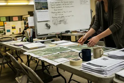
Step 1: Build the base map
- Download municipal zoning maps for every town in the county.
- Add county parcel or tax-lot data if it is publicly available.
- Add public land boundaries, road centerlines, hydrology layers, and 30-meter land-cover data.
- Load the layers into a free desktop GIS.
- Symbolize forest, agriculture, wetlands, public lands, and low-density residential zones separately.
Do not start by drawing the corridor you want. Start by letting the constraints show themselves. High-speed roads, dense valley development, steep parcel fragmentation, and zoning that permits scattered residential buildout can break a corridor even where satellite imagery still looks mostly forested.
Step 2: Add the prey and conflict layers
- Add state deer management-unit maps.
- Add deer-density reports where the state publishes them.
- Add harvest summaries, deer-vehicle collision hotspots, and forest-regeneration or browse-impact reports.
- Prioritize corridors where forest cover, public land, riparian buffers, and deer presence overlap.
This step keeps the map honest. A corridor without prey support is just cover. A prey-rich area cut by road mortality and subdivision pressure is a conflict forecast. The strongest candidate zones usually show overlap: connected forest, some public or conserved land, watercourse protection, and a deer record that fits long-term predator movement.
Step 3: Turn the map into a board-ready request
- Produce one county-scale map.
- Produce one zoomed map of the proposed corridor.
- Write a one-page proposal with three requests: protect the corridor from high-fragmentation zoning, require wildlife-sensitive review for new road or subdivision permits inside the corridor, and create a local reporting protocol for large-carnivore observations or livestock conflicts.
A realistic volunteer workflow is roughly 6 to 10 hours of map assembly, a couple of hours of checking deer and road-conflict records, and several hours to draft the proposal. Keep the ask narrow. A town board can act on zoning review, permit conditions, and reporting procedures faster than it can resolve the whole future of cougar recovery.
For a worked case, take a county with a north-south ridge, a state forest on the western slope, farms in the central valley, and a river corridor on the eastern edge. On Monday evening, load zoning, roads, public lands, hydrology, and 30-meter land cover into QGIS. On Tuesday, mark the two places where forest still reaches the river without crossing dense residential zoning. On Wednesday, add deer management-unit material, harvest summaries, and deer-vehicle collision hotspots; reject the southern option if it runs straight into the collision cluster near the highway interchange. On Thursday, export two maps: one county view and one corridor close-up. On Friday, submit a one-page memo asking the planning board to flag that corridor for wildlife-sensitive review, avoid high-fragmentation zoning inside it, and route any large-carnivore report through a named municipal contact who forwards evidence to the state wildlife agency.